
Jangadna 2027: Satellite Image से EB का नजरी नक्शा कैसे बनाएं?
Satellite imagery, Enumeration Block (EB), landmarks और mapping को आसान भाषा में समझें।
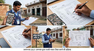
यह लेख सामान्य informational और educational guidance के लिए है। Census 2027 की वास्तविक field procedure, mapping instructions, app workflow, numbering और अन्य operational requirements के लिए हमेशा Office of the Registrar General & Census Commissioner, India (ORGI) के नवीनतम निर्देश, training material और अपने Supervisor/Charge Officer के निर्देशों को प्राथमिकता दें।
Jangadna 2027 में EB नजरी नक्शा क्या है?
Census 2027 की Houselisting and Housing Census प्रक्रिया में Enumeration Block (EB) और क्षेत्र की सही पहचान महत्वपूर्ण है। Census mapping का उद्देश्य enumeration areas को स्पष्ट रूप से demarcate करना और coverage में omission तथा overlapping की संभावना को कम करना है।
Official Census material के अनुसार mapping activities Census operations का महत्वपूर्ण हिस्सा रही हैं और maps का उपयोग enumeration areas की boundaries को स्पष्ट करने के लिए किया जाता है। :contentReference[oaicite:2]{index=2}
Satellite image इस काम को समझने में एक उपयोगी visual reference दे सकती है, लेकिन किसी field worker को केवल इस article में बताए सामान्य steps के आधार पर official map या field boundary को final नहीं करना चाहिए।
1. EB और नजरी नक्शा क्यों महत्वपूर्ण है?
Enumeration area की स्पष्ट पहचान field-level coverage को व्यवस्थित रखने में मदद करती है। Census mapping का एक प्रमुख उद्देश्य areas को इस प्रकार demarcate करना है कि enumeration में क्षेत्र छूटे नहीं और overlap न हो। :contentReference[oaicite:3]{index=3}
- EB या enumeration area की सीमा
- मुख्य सड़कें और रास्ते
- बस्ती, मोहल्ला या गांव के नाम
- स्कूल, अस्पताल और अन्य प्रमुख landmarks
- नदी, नहर, तालाब जैसी स्पष्ट geographic features
- ऐसे permanent reference points जिनसे क्षेत्र की पहचान आसान हो
ध्यान रखें कि इनमें से कौन-सी चीज किस format में दर्ज या map की जानी है, यह official instructions और local Census authorities के निर्देशों पर निर्भर कर सकता है।
2. Satellite Image से EB क्षेत्र को कैसे समझें?
Satellite image का सबसे उपयोगी पहलू यह है कि इससे किसी क्षेत्र की roads, buildings, open areas और geographic features को visual context में देखा जा सकता है।
1 पहले official boundary को प्राथमिकता दें
किसी भी satellite image को official Census boundary का substitute न मानें। पहले अपने उपलब्ध official map, EB information या Supervisor/Charge Officer से प्राप्त निर्देश को देखें।
2 Satellite view से area पहचानें
इसके बाद satellite imagery का उपयोग roads, buildings, open spaces और prominent landmarks को पहचानने के लिए किया जा सकता है।
3 Ground reality से मिलान करें
Satellite imagery हमेशा current ground situation को पूरी तरह represent नहीं करती। इसलिए field verification और official instructions को प्राथमिकता देना जरूरी है।
4 Final submission official procedure के अनुसार करें
Article में दिए गए सामान्य mapping concepts को final official submission procedure न समझें। Final format, numbering और app-based workflow के लिए latest official training material देखें।
3. Satellite Map पर कौन-से landmarks उपयोगी हो सकते हैं?
Field area को पहचानने और navigation समझने के लिए ऐसे permanent landmarks उपयोगी हो सकते हैं जो ground पर आसानी से पहचाने जा सकें।
| Reference | उपयोग |
|---|---|
| मुख्य सड़क | क्षेत्र तक पहुंच और boundary orientation समझने में मदद |
| स्कूल | स्थानीय पहचान के लिए useful landmark |
| अस्पताल / स्वास्थ्य केंद्र | स्थायी reference point |
| धार्मिक स्थल | स्थानीय क्षेत्र की पहचान में मदद कर सकता है |
| नदी / नहर / तालाब | Natural geographic reference |
| बड़ा junction | Road network समझने में सहायता |
4. Practical Workflow: Satellite Image को कैसे इस्तेमाल करें?
- अपने assigned enumeration area/EB की official information देखें।
- उपलब्ध official map या boundary information को reference बनाएं।
- Satellite imagery में उसी area को locate करें।
- Roads, buildings और permanent landmarks को identify करें।
- Satellite view और ground reality के बीच संभावित अंतर को ध्यान में रखें।
- किसी भी discrepancy को अपने Supervisor/Charge Officer के निर्देशों के अनुसार resolve करें।
- Final mapping या app submission केवल latest official procedure के अनुसार करें।
5. Census 2027 के Official Sources
Census 2027 से संबंधित जानकारी के लिए official Census website को प्राथमिक source मानना सबसे सुरक्षित तरीका है।
🏛️ Census of India / ORGI
Official Census website पर Census 2027 से संबंधित notifications, schedules, digital resources और अन्य official material उपलब्ध हैं।
Official Census of India Website →
Official ORGI material में Census 2027 की Houselisting Operations से संबंधित notification उपलब्ध है। :contentReference[oaicite:4]{index=4}
ORGI की official mobile-app information में Census 2027 – Houselist और Census 2027 – Houselist Training apps का उल्लेख किया गया है। :contentReference[oaicite:5]{index=5}
6. सबसे जरूरी सावधानी
Satellite imagery में दिखाई देने वाली road, building या boundary हमेशा current official field situation से पूरी तरह match नहीं कर सकती। इसलिए इसे supporting visual reference की तरह समझें और final Census work के लिए official instructions तथा authorised field guidance को प्राथमिकता दें।
7. अक्सर पूछे जाने वाले प्रश्न (FAQs)
Q1. क्या Satellite Image से EB की official boundary बनाई जा सकती है?
Satellite image visual reference दे सकती है, लेकिन official EB boundary के लिए Census authorities द्वारा उपलब्ध कराई गई authoritative information और instructions को प्राथमिकता दी जानी चाहिए।
Q2. क्या Google Earth की image हमेशा latest होती है?
नहीं। अलग-अलग locations में imagery की date अलग हो सकती है। इसलिए satellite image को current ground reality का exact substitute नहीं मानना चाहिए।
Q3. Census 2027 के लिए कौन-सा official app उपलब्ध है?
ORGI की official information में Census 2027 – Houselist और Census 2027 – Houselist Training apps listed हैं। :contentReference[oaicite:6]{index=6}
Q4. क्या इस article के steps से final Census map तैयार किया जा सकता है?
यह article general educational guidance है। Final map, numbering और field procedure के लिए latest official Census instructions तथा अपने authorised supervisor/official guidance को follow करें।
Q5. Census mapping का मुख्य उद्देश्य क्या है?
Census mapping enumeration areas की geographic identification और boundaries को स्पष्ट करने में मदद करती है, ताकि coverage में omission और overlapping को कम किया जा सके। :contentReference[oaicite:7]{index=7}
Disclaimer: Data Digest एक independent informational website है। यह लेख सामान्य educational और informational purpose के लिए है। Census 2027 की official process, dates, instructions, app workflow या field-level requirements में बदलाव हो सकते हैं। किसी भी official work के लिए Office of the Registrar General & Census Commissioner, India (ORGI) और authorised Census officials के latest instructions को प्राथमिकता दें।